Global Heritage - Foundations of Global Heritage: Cities, Cultures, and Continuities
Foundations of Global Heritage Webinar Introduction
Overview of the Webinar Series
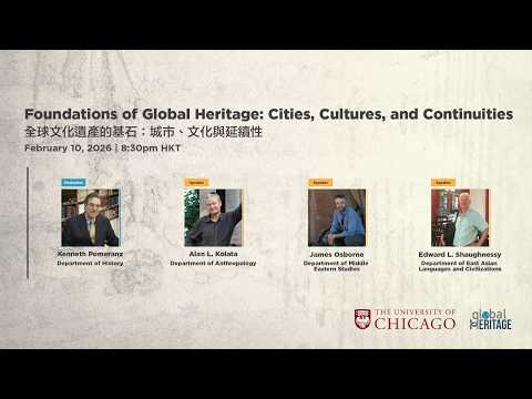
- Ken Pomerance introduces himself as the faculty director at the University of Chicago's Hong Kong campus and welcomes attendees to the "Foundations of Global Heritage" webinar.
- The series aims to connect academics, heritage professionals, museum curators, and archivists to discuss how cultural heritage influences societies over time and space.
- Attendees are encouraged to submit questions via Zoom after registering and visit the university's website for updates.
Speaker Introductions
- Professor Alan Colada is introduced as a distinguished service professor in anthropology with research interests in agroecological systems, urban social ecology, and human-environment interactions.
- Professor James Osborne specializes in Anatolian archaeology, focusing on monumental buildings and settlement patterns during the Bronze Age and Iron Age in Turkey.
- Professor Ed Shaughnessy is noted for his expertise in ancient Chinese studies, particularly bronze inscriptions and literary traditions from ancient China.
Research Focus: Alan Colada's Presentation
Andean Civilizations
- Colada discusses his research areas in Western South America, including coastal Peru, Andean highlands (Inca Empire), and Lake Titicaca basin.
- He emphasizes large-scale landscape transformations by early civilizations through advanced agro-engineering techniques that supported urban societies over long periods.
Coastal Civilizations
- The earliest civilizations were located along coastal Peru; he presents a NASA satellite image illustrating diverse landscapes crucial for understanding these cultures.
- The image highlights riverine civilizations' reliance on irrigated agriculture amidst challenging geographical conditions.
Technological Innovations
- Colada notes that these civilizations developed sophisticated technologies necessary for agricultural success in both arid coastal regions and highland areas.
Understanding the Agricultural Systems of Coastal Peru and the Altiplano
Coastal Regime and Irrigated Agriculture
- The coastal regime in Peru faces challenges due to high altitude, impacting food production necessary for sustaining local economies.
- A recent photograph illustrates the arid environment along the Pacific coast, highlighting the difficulties faced by Peruvian populations in agriculture.
- Karal, located on the central coast of Peru, is recognized as one of the earliest urban complexes with evidence of major irrigated agriculture dating back over 4,000 years.
- The region's economy combined maritime resources with irrigated agriculture; notable fisheries off western South America contributed significantly to this dual economy.
- The Chimu culture's capital city, Chanchchan, exemplifies advanced agricultural practices within a densely populated urban area.
Technological Engineering and Urban Gardens
- Chanchchan spans six to seven square kilometers and features extensive irrigated landscapes surrounding it.
- Within urban areas like Chanchchan, large gardens (wakakeis) were integrated into city life, showcasing sophisticated agroengineering techniques that utilized groundwater effectively.
- An image depicts crops growing in these urban gardens; ancient agricultural systems are still in use today alongside modern fields.
- The aqueduct system linked multiple coastal valleys over hundreds of kilometers, forming an integrated landscape crucial for crop production.
- Scholars refer to this network as a "hydraulic empire," emphasizing its reliance on large-scale irrigation for crops such as corn.
Resilience Against Environmental Challenges
- Archaeological canals demonstrate continuity in agricultural practices; modern canals often overlay ancient ones while still serving current agricultural needs.
- These complex irrigation systems were technologically advanced and adapted to environmental contours; they remain vital for contemporary farming operations despite modernization efforts by agribusinesses.
- The population around Chanchchan likely ranged from 50,000 to 100,000 people; irrigation was essential for supporting both urban centers and surrounding settlements.
- Coastal Peru faces risks from El Niño phenomena which can cause catastrophic floods or drought; historical records show resilience through rebuilding efforts rather than systemic collapse.
Insights into the Altiplano Region
- Transitioning focus to Bolivia's Altiplano region reveals significant challenges for agricultural production at altitudes above 3,800 meters.
Tiwanaku: An Ancient Civilization
Overview of Tiwanaku
- Tiwanaku was a significant state and empire that expanded from the Altiplano into parts of Chile and Argentina, showcasing its architectural heritage through ceremonial complexes and palace structures.
- The city served as a center for the elite of Tiwanaku, characterized by wealth derived from long-distance trade relationships throughout central and southern Peru.
Population and Agriculture
- The entire valley surrounding Tiwanaku had an estimated population of about 1.1 million, while the city itself housed approximately 20,000 to 50,000 people.
- High-altitude agriculture at 3,800 meters posed challenges; crops like maize were difficult to grow, but Andean high-altitude crops such as potatoes and quinoa thrived in this environment.
Agroecological Engineering
- The city's layout was synchronized with agricultural cycles, using large pillars or monoliths to mark seasonal changes important for farming activities.
- Raised fields known as sukul koyus covered over 90,000 hectares around Lake Titicaca; these fields utilized sophisticated technology adapted to local environmental conditions.
Challenges in Agriculture
- A World Bank assessment deemed the landscape unsuitable for human habitation due to nutrient-poor soils and frost damage risks; however, indigenous practices proved otherwise.
- Catastrophic drought and frosts could reduce crop yields significantly (up to 90% in severe years), highlighting the need for resilient agricultural systems.
Technological Innovations
- The raised field system functioned as a solar heating mechanism; canals absorbed solar energy during the day and released it at night to protect crops from frost.
- Water canals were colonized by organic matter that decomposed over time, acting both as a fertilizer source and enhancing soil quality for sustainable agriculture.
Community Rehabilitation Efforts
- Community efforts led by Laaya aimed at rehabilitating these ancient fields demonstrated their productivity potential through successful potato harvest experiments.
Agricultural Innovations in the Andean World
Indigenous Agricultural Practices
- The indigenous populations of Tuanakaco utilize a form of agriculture that yields two to eight times more harvest than traditional methods introduced during the Spanish colonial period, showcasing its effectiveness.
The Inca Empire's Agricultural Foundation
- The Inca Empire spanned 4,000 kilometers from Chile to Colombia and was fundamentally based on innovative agricultural practices adapted to diverse ecological constraints like frost and nutrient-poor soils.
Infrastructure Supporting Agriculture
- The Inca developed an extensive road system over 40,000 kilometers that connected various agricultural landscapes, facilitating trade and communication across the empire.
Terracing Techniques
- Machu Picchu exemplifies the use of mountain terraces for agriculture; these terraces served both productive and aesthetic purposes, integrating urban life with agricultural production.
Storage and Preservation Methods
- The Inca established sophisticated storage facilities known as koka or store rooms throughout their empire, allowing them to preserve crops like corn and potatoes for extended periods through techniques such as freeze-drying.
Living Heritage of Andean Agriculture
- Current agricultural practices still reflect ancient systems; many Inca terraces are actively cultivated today while some raised fields are being restored, demonstrating a continuity between past and present agricultural methods in the Andean region.
Overview of Urbanism in Ancient Anatolia
Introduction to the Topic
- Thanked Kenneth for the invitation and greeted attendees from Chicago and Hong Kong. Discussed the focus on significant developments in urbanism and urbanization in ancient Anatolia (Turkey) as a specialty area.
Focus Areas of Discussion
- The presentation will concentrate on specific episodes, particularly the Neolithic period and the Bronze and Iron Age periods in South Central Anatolia, similar to Professor Colada's approach.
- Brief mention of contemporary landscape water management issues that echo historical developments at the end of the talk. Acknowledged selective nature due to vastness of Anatolian history.
Geographic Context
- Turkey's size is larger than all Middle Eastern countries combined, highlighting its complexity and social variety throughout history. This includes Cyprus, Israel, Palestine, Lebanon, Syria, Jordan, and Iraq.
- Notable cultural differences exist across regions: mountainous highlands in the east versus Mesopotamian civilization in the southeast; western areas share similarities with ancient Greece; central Anatolian plateau represents a unique cultural expression discussed today.
Rich Cultural History
- Turkey is recognized as one of the richest archaeological zones globally; even casual excavations by locals often yield significant finds like coins. The sheer volume of material presents intellectual challenges for archaeologists working in this space.
- The discussion will cover early agropastoral villages during the Neolithic period and early states within Hittite Empire during late Bronze Age while briefly touching on present-day issues related to water management at the end. Proper analysis would require more extensive exploration over a longer seminar format.
Unique Environmental Characteristics
- Unlike riverine civilizations such as Mesopotamia or Egypt that are defined by their rivers (Euphrates/Tigris or Nile), central Anatolian plateau lacks navigable rivers crucial for sustaining complex societies historically associated with such features. Instead, it is characterized by dryness which shapes its civilization development differently.
- Coastal regions (Black Sea north & Mediterranean south) experience high rainfall compared to inland areas where conditions are arid despite hot temperatures—this stark contrast influences societal structures significantly within these environments.
Case Study Region: Konya Plain
- The Konya plain is highlighted as an interesting case study due to its dry climate contradicting common assumptions about water being integral to civilization origins; complex societies thrived here despite limited precipitation and absence of major navigable rivers typically seen elsewhere in ancient cultures.
Exploring the Central Anatolian Plateau
The Unique Landscape of Central Anatolia
- The central Anatolian plateau is characterized by its stark beauty, differing significantly from the lush Mediterranean landscapes typically associated with Turkey.
- This region is often overlooked by tourists who prefer coastal Greek cities and beaches, making it less visited despite its rich archaeological significance.
Archaeological Significance
- The plateau is home to numerous archaeological sites, including mounds known as huyuks (in Turkish) or tells (in Arabic), formed over centuries through layers of settlement.
- These artificial hills can be recognized by trained eyes, revealing thousands of years of human occupation beneath their surfaces.
The Conia Basin: A Unique Exception
- The Conia basin stands out in the context of ancient civilizations in Anatolia due to its relationship with water, particularly during the last glacial maximum when it was covered by a paleo lake.
- This area features a river called Charambo that flows into an endorheic basin, creating a fertile agricultural landscape through alluvial deposits from surrounding mountains.
Agricultural Richness and Archaeological Sites
- The rich soils deposited by the Charambo River have led to hundreds of archaeological sites dating back to various periods, showcasing settlements that thrived on this fertile land.
- Notable sites include Çatalhöyük, one of Turkey's most famous archaeological locations, which reflects early agricultural practices and sedentary lifestyles during the Neolithic period.
Modern Developments at Çatalhöyük
- Today, Çatalhöyük has transformed into a world heritage site featuring modern amenities like museums and parking lots alongside its historical mounds. Visitors can explore both ancient structures and contemporary facilities that enhance their experience.
- Despite these developments, the site remains significant for understanding Neolithic life and agriculture in Turkey's history as it represents one of the largest settlements of its time with around 2,000 inhabitants.
Chatalhoyuk: Understanding the Neolithic Settlement
Social Structure and Environment
- The evidence suggests that Chatalhoyuk had a highly egalitarian social structure with little to no social stratification during the 7th millennium BC.
- Geological cores were conducted around the site to reconstruct the ancient environment, revealing significant differences from today's landscape.
- Soil scientists analyze soil samples at various depths to understand past plant and water life, dating these samples using radiocarbon methods.
- Contrary to earlier beliefs, Chatalhoyuk was not isolated by marshland but featured a varied landscape with raised areas and low river branches conducive to agriculture.
- This diverse environment allowed for a wide variety of crops, leading to rich dietary patterns among inhabitants due to micro-environments just meters apart.
Architectural Features
- A notable characteristic of Chatalhoyuk is its lack of streets; access to buildings was primarily through roofs, indicating a unique social interaction space above ground level.
- The settlement exhibits no signs of social complexity in architecture; all houses are similar in size without any prominent elite structures or palaces.
- Houses were built closely together with no gaps between them, reflecting a communal living style that emphasizes shared space rather than individual property lines.
Continuity and Symbolism
- There is remarkable architectural continuity over time; building plans remained consistent for up to 700 years despite changes in use and occupancy.
- Archaeological profiles show stacked walls of successive buildings, indicating that old structures were often reused rather than replaced entirely.
- The interior walls of houses were plastered and painted richly, suggesting a complex symbolic regime where art reflected community identity and possibly urban planning concepts within their artwork.
Exploring the Archaeological Significance of Çatalhöyük
Overview of Çatalhöyük Excavations
- The speaker discusses a recent excavation photograph showcasing an entirely excavated house at Çatalhöyük, highlighting the presence of additional walls from unexcavated houses nearby.
- The visibility of these walls provides archaeologists with tantalizing prospects for further excavation, suggesting that more structures similar to the already-excavated house exist in close proximity.
Domestic Ritual Practices in Neolithic Period
- The speaker describes bizarre domestic rituals observed at Çatalhöyük, such as living rooms featuring platforms surrounded by skulls encased in plaster, including those of an extinct bull species known as orox.
- A leopard skull was also found incorporated into the wall plaster; this practice is referred to as "incorporations" by archaeologists who study these layers over time.
- Upon peeling back layers of plaster, archaeologists discovered handprints and human remains buried beneath the floors, indicating that deceased family members were interred within their living spaces.
Symbolism and Architecture
- The houses at Çatalhöyük are described as symbolically rich environments where architecture itself contains significant cultural symbols alongside human remains placed underfoot.
- This creates a highly charged atmosphere within these homes, emphasizing their importance in both daily life and ritual practices.
Transitioning to the Bronze Age: Hittite Empire
Characteristics of Hittite Society
- Fast-forwarding 4.5 thousand years to around 1500 BCE, ancient Anatolia is characterized by the expansive Hittite Empire which incorporates all regions politically.
- Unlike the egalitarian structure seen during the Neolithic period at Çatalhöyük, society has become stratified with large settlements indicative of political complexity.
Excavation Insights from Turkman Karuik
- The speaker mentions their excavation site Turkman Karuik, which is significantly larger than Çatalhöyük and showcases nearly 3,000 years of continuous occupation.
- This site reflects new political complexities through its scale and organization compared to earlier periods.
Ideological Landscape Usage
- Unlike previous subsistence strategies evident in Neolithic times, landscape usage during the Hittite period is ideologically integrated into state religion and governance.
- An example includes artificial pools built around natural springs serving as monuments that reinforce Hittite imperial ideology across Anatolia.
Representation in Hittite Cosmology
- A specific landscape monument features mountain gods sustaining life on earth through water sources depicted in sculptures; this illustrates aspects of Hittite cosmology intertwined with nature's elements.
The Role of Water in Religious Ideology
Importance of Water Sources
- In stark, dry landscapes, water sources like springs are crucial for accessing the divine realm, highlighting their religious significance.
- The state exploits these vital water resources to reinforce its ideological system.
Landscape Monuments and Religious Practices
- The cona plane features significant landscape monuments, including Karada (dark mountain) and Kuza (crimson mountain), which are visible from various locations.
- The Hittite state utilized mountains ideologically by placing landscape monuments on them; inscriptions by King Hartapu proclaiming his devotion to the Hittite pantheon were found at Karada's summit.
Ritual Processions and Community Engagement
- A reconstructed royal ritual procession would travel from Turkman Karuik across a lake to Kuzda, integrating the populace into the religious state apparatus.
- During rituals, King Hartapu would address the community from elevated positions, reinforcing his authority and connection to the divine.
Contemporary Water Management Issues
- Current water management remains critical for local residents; historical exploitation has led to significant environmental changes in the region.
- Urban planners' attempts to restore a drained lake with infrastructure projects have proven futile as the landscape reverts to its original barren state.
Transitioning Perspectives: Archaeological Insights
Introduction of New Perspectives
- Ed Shaughnessy introduces himself as an outlier among archaeologists, focusing on riverine cities rather than traditional archaeological topics.
Historical Context of Anyang
- Anyang is highlighted as one of China's first major cities (1250 - 1050 BC), known for oracle bones that sparked archaeological interest in China.
Archaeological Significance
- Modern excavations at Anyang began under Academia Cynica and marked it as a key cultural heritage site in China since 1950.
Anyang Excavations and Historical Insights
Overview of Anyang's Historical Significance
- After the founding of the Republic in 1949, Anyang has been continuously excavated for 75 years, with a conservative population estimate exceeding 100,000 people.
- Oracle bone inscriptions were uncovered shortly after excavations began, providing context to reconstruct the history of the late Shang dynasty.
Key Discoveries at Anyang
- The largest royal tomb in Anyang was excavated in 1934 but was found completely robbed, leaving little behind for archaeologists to study.
- Hurley Creel visited the site in 1935; his book "The Birth of China," discussing ongoing excavations, has recently been translated into Chinese for the first time.
Major Archaeological Findings
- In June 1937, a pit containing 17,000 turtle shell pieces was discovered, significantly impacting historical writing about this era during King Wuing's reign.
- Due to Japanese military advances, archaeologists had to transport findings from Nanjing to Yunan quickly.
Continued Excavation Efforts
- Oracle bones continue to be discovered; nearly 600 oracle bones were found near the palace district in 1990—these represent some of China's earliest writing forms.
Geographic Context and Recent Developments
- A topographical view shows Anyang's location relative to significant landmarks like Yinshi Museum and its proximity to river systems that influenced settlement patterns.
- Recent excavations have revealed multiple workshops and warehouses across the river from royal cemeteries where eleven kings were buried during Anyang's occupation.
The Historical Significance of the Joyan Site
Overview of the Joyan Site and Its Inhabitants
- The Joyan site, located about 100 kilometers west and slightly north of modern-day Xi'an, was the homeland of the Zhou people who overthrew the Shang dynasty around 1045 BC.
- First settled approximately in 1150 BC, this area saw migration from further east into a region known as "Forked Mountain" (Chiang) in Chinese.
Development and Capital Establishment
- A century after settling, a Zhou king established a capital city along the Fun River, which is a tributary of the Wei River near modern-day Xi'an. His son later built another capital called Hao to the east of Fun River after overthrowing the Shang dynasty.
- Recent archaeological findings suggest that rather than Fun or Hao, the actual capital may have been at Joyan (also referred to as Tongjo), challenging previous assumptions about its significance.
Archaeological Discoveries
- Excavations in the 1970s revealed numerous tombs and caches containing bronze vessels buried for safekeeping during invasions around 771 BC, marking an important period in Zhou history.
- New excavations starting in 2020 indicate that Joyan was likely a major city with significant population density contrary to earlier beliefs that it served merely as a ritual center with low habitation levels.
Cultural Heritage Insights
- The layout of structures discovered at these sites resembles traditional Chinese palatial designs seen throughout history, including features like central courtyards and living spaces similar to those found in Beijing's Forbidden City.
- Oracle bones discovered at one excavation site represent some of the earliest forms of writing from this era, providing crucial insights into Zhou culture and governance practices during what is considered China's golden age.
Archaeological Insights into Ancient Civilizations
Overview of the Site and Its Significance
- The discussion begins with a geographical overview, focusing on the Shishan Hooked Mountain to the north and its relation to an archaeological site built on the Joe River.
- The city spans approximately 15 square kilometers, comparable in size to Hyde Park in Chicago. Walking around its perimeter takes about five to six hours.
- A color-coded aerial view reveals densely occupied areas, with dark red indicating building foundations and light red showing walls that enclosed the site. Roads were constructed to prevent foot traffic over roofs.
Cultural Heritage and Historical Context
- The Shang site at Anyong is noted as one of China's first three dynasties, burned by Joe invaders in 1045 BC. It was later known as Yinshu, meaning "the waste of yin."
- Oracle bones discovered at Anyong significantly advanced modern archaeology in China, reshaping historical narratives.
- The Joyan served as a capital for the Joe people from 1045 to 771 BC but was also eventually overrun. Artifacts indicate burial practices involving bronze vessels.
Migration Patterns and Cultural Diversity
- Following invasions, both Shang and Joe cultures faced significant changes; artifacts reveal insights into their societal structures through excavations by archaeologists and tomb robbers.
- Questions arise regarding migration patterns into these regions and evidence of multiple contemporaneous cultures within these sites.
Ethnic Diversity in Ancient Empires
- Alan discusses his course on Inca and Aztec states, highlighting how the Inca Empire integrated diverse ethnic groups through language (Keshwa), agriculture, and resource redistribution during ecological crises.
- Over time, the Inca incorporated around 210 different ethnic groups while maintaining social cohesion through various means of integration.
Hittite State Migration Insights
- James elaborates on migration patterns related to the Hittite state. He notes that Hittite language is among the earliest recorded Indo-European languages linked to ongoing debates about proto-Indo-European origins.
- Evidence suggests that Hittites may have migrated from regions like Pontic or Caspian steppe into Anatolia, contributing significantly to cultural exchanges across Europe.
This structured summary encapsulates key discussions surrounding archaeological findings related to ancient civilizations while providing timestamps for easy reference.
The Role of Mobility in Human History
Importance of Mobility
- New technologies, particularly ancient DNA analysis, are revealing the significance of human mobility throughout history, emphasizing that it is a defining characteristic of humankind rather than permanence.
- Ed agrees with James on the constant movement of people, noting that ancient China also experienced significant migrations and cultural exchanges.
Cultural Innovations in Ancient China
- Various cultural innovations entered China from regions like the Transcaucasus and Turkey, including the introduction of the chariot at Anyong.
- The diversity among peoples in different agricultural zones across China has been a consistent theme throughout its history.
Origins of Writing
- Writing was first developed in Mesopotamia around 3,300 BCE but took another 1,500 years to be adopted in Anatolia despite awareness of writing technology.
- The earliest writing found in Turkey dates back to about 1900 BCE by Mesopotamian traders; local Anatolian adoption occurred approximately 300 years later.
Recommended Reading on Writing Systems
- Teao Vandenhout's book "A History of Hittite Literacy" is recommended for understanding Hittite writing systems and their decipherment.
- The development of writing is contested; notable early centers include Mesopotamia, Egypt, China, and Mesoamerica. Connections between these regions suggest possible interactions.
Chinese Writing Development
- China's claim to have independently developed writing coincides with other technological advancements such as bronze usage and chariot introduction.
- A comparative book edited by Steven Hston discusses various early writing systems; "Chinese Writing" by Chosi Quay is highlighted as an excellent resource for understanding Chinese script origins.
Closing Remarks and Opportunities
Educational Programs Announcement
- Upcoming summer programs at Chicago's Hong Kong campus will run from July 13th to 31st for high school students, taught by Chicago faculty at an introductory level.
Additional Resources
- Listeners are encouraged to explore podcasts featuring Chicago faculty discussing their academic journeys available on platforms like Apple and Spotify.