RELIEVE DEL TERRITORIO PERUANO: COSTA, SIERRA Y SELVA
New Section
The speaker introduces the topic of discussing the physical characteristics of the Peruvian geographical environment.
Physical Characteristics of the Peruvian Geography
- The Peruvian coast spans 3,080 kilometers and covers 137,133 square kilometers, representing 10.6% of the national territory. It ranges from sea level to 500 meters above sea level, with varying widths across different regions.
- The coast is divided into three main sections: south coast, central coast, and north coast. Each section has a different climate - semi-tropical in the south and subtropical in the central and north.
- The coastal areas are further categorized based on latitude, with distinct features such as river terraces that give rise to coastal valleys and alluvial plains known as "pampas."
- Terraces along the coast are formed due to tectonic movements and erosion processes. These terraces have significant agricultural potential but require water for cultivation.
- Notable features within the coastal relief include "tablazos," which are uplifted terraces formed by geological processes. These tablazos vary in size and play a crucial role in agriculture and industrial activities.
Exploring Coastal Features
This section delves deeper into specific coastal features found in Peru.
Coastal Features
- Tablazos like Máncora, Ica, Piura, and Tumbes are significant for their geological formations and economic activities such as oil extraction.
- Pampas are alluvial plains with agricultural potential found along the coast. Major pampas include Guaymas, Llanada, Clemes, among others.
- The Cordillera de la Costa runs parallel to the coastline and includes peaks like Cerro Tunga in Ica. Deserts like Sechura Desert exhibit minimal vegetation due to arid conditions.
Understanding Coastal Landscapes
This part focuses on diverse landscapes present along Peru's coastline.
Coastal Landscapes
- The desert regions like Sechura Desert boast extensive sand dunes that constantly shift due to wind forces. Notable oases like Huacachina provide unique ecosystems within arid environments.
- Lomas are characterized by fog-induced ecosystems supporting diverse flora despite arid surroundings. Moon Valley (La Luna Grande) stands out for its height and ecological significance.
Detailed Geographic Features of Peru
The speaker discusses various geographic features of Peru, including lomas, médanos, puntas, penínsulas, bahías, playas, acantilados, and depresiones.
Lomas and Médanos
- Lomas are vegetated hills that extend to the coast due to persistent garúas and neblinas caused by thermal inversion. The most famous loma is Loma de la Calle Lima.
- Médanos are sand dunes with a rocky base. In Peru, notable médanos include Médanos de Corvina and Pasa Mal.
Puntas and Penínsulas
- Puntas are small land portions entering the ocean; larger ones are called penínsulas. Examples in Peru include Punta Coles (most northern), Punta Blanca (most southern), Punta Callao (most populated), Punta Balcones (most western), and Punta Blanca (most eastern).
Bahías and Playas
- Bahías are oceanic water entries; significant ones include Callao Bay (important gulf) and Sechura Bay (largest bay).
- Playas are coastal reliefs formed by wave deposits; notable ones in Peru include Cantolao in Lima.
Geological Formations: Acantilados and Depresiones
This part covers acantilados (cliffs) as rock formations at varying heights along the coast. Additionally, it discusses depresiones as lowland areas below sea level filled with water exploited for salt extraction.
Acantilados
- Acantilados are rocky formations reaching different height levels along the coast.
- These cliffs vary in height based on their location.
Depresiones
- Depresiones are lowlands below sea level due to geological faults or tectonic movements.
- They fill with water due to proximity to the ocean; major depressions in Peru include Bayóvar Depression (-37 meters) in Piura.
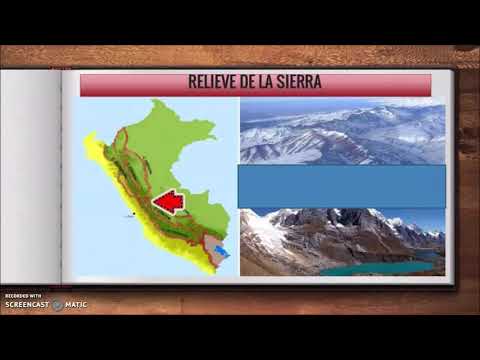
Andean Mountain Range of Peru
The Andean mountain range in Peru spans from 800 to 6,768 meters above sea level. It includes significant peaks like Nevado Huascarán covering 28% of national territory.
Andean Mountain Range
- The Andes cover a wide altitude range from 800 to 6,768 meters above sea level.
- Nevado Huascarán is a prominent peak covering a substantial portion of Peruvian territory.
Cordilleras Division
Overview of Andean Geography
This section provides an overview of the geographical features of the Andes in Peru, highlighting key mountain ranges, valleys, lakes, and canyons.
The Andean Knot
- The area from Pasco to where it divides is known as the "Andean Knot."
- It splits into the Black Mountain Range and the White Mountain Range.
- These ranges converge at the Andean Knot.
Central Andes of Northern Peru
- Known as the Cordillera del Cóndor in Amazonas and Cajamarca.
- Includes the Abiján Atxaga Impact.
- Also encompasses the Northern Oriental Chain, also called Cordier Acampantes or Cerro Campantes in Amazonas and Loreto.
Unique Geographical Features
- The longest mountain range globally spans Chile, Bolivia, Argentina, Peru, Ecuador, Colombia, and Venezuela.
- The highest tropical mountain range is within the Andes - Cordillera Blanca.
- Mount Huascarán is noted as the highest tropical peak.
Geographical Wonders of Peru
This segment explores remarkable geographical features in Peru such as mountains, canyons, lakes, and plateaus.
Diverse Landforms
- Highest volcano: Coropuna in Arequipa.
- Deepest canyon globally: Cotahuasi Canyon.
- Most beautiful volcano: Misti Volcano in Arequipa.
Mesetas and Valleys
- Largest plateau: Collao Plateau between Peru and Bolivia.
- Highest navigable freshwater lake globally: Lake Titicaca at 3,812 meters above sea level.
Valleys and Canyons
Discussing valleys' significance for agriculture along with notable valleys like Mantaro Valley and Urubamba Valley.
Agricultural Importance
- Valleys are crucial for agriculture due to their fertile lands.
Prominent Valleys
- Mantaro Valley is extensive, productive, and densely populated.
- Urubamba Valley (Sacred Valley of Incas), Colca Valley in Arequipa,
Ayabaca-Huancabamba Tura Valley,
Cajabamba-Condebamba-Cutervo-
Contumazá Valley,
Santiago de Chuco in La Libertad,
New Section
In this section, the speaker discusses various valleys in the Peruvian jungle region, highlighting their unique characteristics and primary agricultural productions.
Valleys in the Peruvian Jungle
- The Omagua lowland jungle is characterized by being the most rugged due to heat generation leading to cloud formation and rainfall. It is known for its tropical forests except for the Blue Ridge.
- The Chanchamayo Valley in Junín is a significant coffee producer, while the Huallaga Valley between Guano and San Martín stands out as the largest coca-growing valley with substantial agro-economic potential.
- Other notable valleys include Bagua and Utcubamba in Amazonas, known for coffee and rice production, and Tingo María, Aucayacu, and Monzón in Huánuco specializing in timber production.
- The Oxapampa-Pichanaki-Ucayali Valley in Pasco is renowned for coffee cultivation, contrasting with Jaén and San Ignacio Valleys in Cajamarca focusing on coffee, fruits, maize, and potatoes.
Diverse Agricultural Productions
- Various regions like Marcapata, Paucartambo (maize producers), Mayo-Tocache-Uchiza-Huayabamba-Rioja-Moyobamba (rice, tobacco, oil palm), Satipo-Chanchamayo-Satipo-San Ramon (coffee), Tambopata-Inambari (coca & coffee) exhibit diverse agricultural outputs.