CÓMO MEDIR UN TERRENO (1/2) | TEODOLITO Y CINTA | TOPOGRAFÍA
Introduction to Topography Techniques
Overview of the Video Series
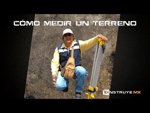
- Maximo Ávila introduces himself as a geodetic survey engineer and explains the purpose of the videos: to share methods and techniques in topography, starting with traditional methods before moving on to new technologies.
Initial Topics Covered
- The first topics will focus on planimetry, progressing as viewers assimilate information. The initial task involves surveying land using compass, tape, and theodolite methods.
Surveying Land: Preparation Steps
Recognizing Terrain
- It is crucial to recognize the terrain in collaboration with an authority or property owner to avoid hindrances during surveying work. Markers such as stakes or rods are used for defining vertices where measurements will be taken.
Setting Up Markers
- Markers (e.g., rods) should be painted for visibility; these serve as defined points for measurement using various equipment depending on the method chosen. A regular four-sided polygon is established visually before precise measurements are taken with instruments.
Measurement Methods Explained
Internal and External Angles
- When measuring angles, instruments must be positioned at designated vertices; however, obstacles like walls or trees may require alternative positioning outside the polygon using radiation methods for distance measurement.
Centering Equipment
- Proper centering of equipment is essential; it should be placed at the lowest point of a marker rod to ensure accurate readings during leveling processes. This involves adjusting tripods to an appropriate height for operator comfort while maintaining accuracy in measurements.
Setting Up Theodolite
Tripod Setup
- The tripod's height should align with the operator's chin when closed; this allows optimal positioning when legs are opened slightly below chest level for stability during use. Proper setup prevents discomfort from awkward postures while operating equipment.
Leveling Techniques
- Traditional methods involve dropping small stones near markers to check alignment; modern digital levels utilize optical plumb lines that require careful adjustment of tripod legs for precision without losing centering during setup procedures.
Final Adjustments and Calibration
Ensuring Stability
- All equipment must remain within sight of operators for safety; protective cases prevent damage from environmental factors like sunlight which can affect instrument integrity over time. Proper mounting ensures compatibility between tripods and devices used in surveying tasks.
Calibration Process
How to Level and Orient a Surveying Instrument
Setting Up the Instrument
- The process begins with adjusting the circular bubble level. A half turn on one screw is sufficient if precision isn't critical.
- If the circular bubble does not remain centered after a 180-degree turn, it indicates that the instrument is unlevel and needs adjustment using plumb bobs from the ceiling or floor.
- The tubular bubble (known as a master mason's level) should be aligned parallel to two screws, ensuring all three feet of the instrument are stable.
- Adjustments require simultaneous movements of two screws; it's crucial to view the tubular level directly from the front to avoid misinterpretation due to parallax errors.
- Once leveled, create a hand-drawn sketch of the terrain, marking details like date and operator while aligning it with true north.
Indexing and Finding North
- The sketch should represent how you perceive the polygon's orientation in relation to north, which will guide further measurements.
- Ensure that all instruments are leveled with batteries installed since their weight can affect leveling accuracy.
- Classic instruments require a full 360-degree rotation both horizontally and vertically for proper indexing before use.
- Use a magnetic compass (topographer’s compass), which has no metal parts and measures angles from 0 to 360 degrees counterclockwise for accurate readings.
- Align your instrument's zero setting with true north as indicated by your compass for consistent azimuth readings.
Measuring Angles
- When measuring angles, note that clockwise measurements correspond to azimuth values even if they appear counterintuitive on some compasses.
- Release the instrument gently while rotating it rightward; this ensures horizontal alignment at all times during measurement processes.
- Utilize an aiming device similar to rifle sights for pinpointing target points accurately before focusing through telescopic lenses for precise adjustments.
- After centering on your target point, record angles meticulously; starting with vertex one provides foundational data for subsequent vertices in your survey plan.
- As you move towards vertex two, maintain awareness of positioning relative to instrument legs—avoid standing directly over them unless absolutely necessary.
Telescopic Measurements and Data Collection
Adjusting the Telescope for Accurate Readings
- The speaker discusses the adjustments made to the telescope, specifically using a tangential screw to fine-tune its focus for accurate readings.
- After aligning with vertex 2, an angle reading of 78 degrees, 48 minutes, and 00 seconds is recorded.
Collecting Angle Measurements from Vertices
- The process continues with vertex 3; it’s crucial to check the base of the beacon for accuracy in angle measurement. An angle of 140 degrees, 23 minutes, and 00 seconds is noted.
- For the fourth vertex, adjustments are made again to ensure precision. The final reading taken is 203 degrees, 22 minutes, and 40 seconds.
Measuring Distances Between Station and Vertices
- Following angular measurements, distances from the station to each vertex are measured as part of calculating polygon perimeter using interior angles.
- A circular level beacon is used to maintain vertical alignment while measuring distances on flat terrain.
Techniques for Distance Measurement
- A fiberglass tape measure is employed due to its suitability for this type of work where high precision isn't critical. Corrections for temperature or tension are deemed unnecessary here.
- The first distance measured from station 1 to vertex 1 is recorded at 11 meters and 70 centimeters.
Finalizing Measurements and Equipment Care
- Subsequent distances are measured:
- Vertex 2: 22.13 meters
- Vertex 3: 21.90 meters
- Vertex 4: 10.86 meters
- With all angles and distances collected, initial calculations can commence before dismantling equipment carefully.
- Proper storage techniques are emphasized; instruments should be stored with screws released to prevent damage during transport.